Aerial mapping, volumes, and progress

Precision Aerial Data for the Sites You Build On

Owls Nest Studio delivers aerial topo mapping, stockpile and earthwork volumes, and construction progress monitoring to contractors, developers, and survey and engineering firms, processed faster and smarter with AI-enhanced workflows.

FAA Part 107 Certified Fully Insured and Bonded FAA-Compliant Operations Secure Data Handling Delaware and the greater tri-state region
A clearer view of the work

Owls Nest Studio was built for one purpose: to give contractors, developers, and survey and engineering firms the aerial data they need to make faster, better-informed decisions.

Interactive deliverables

See the data layer, before you build.

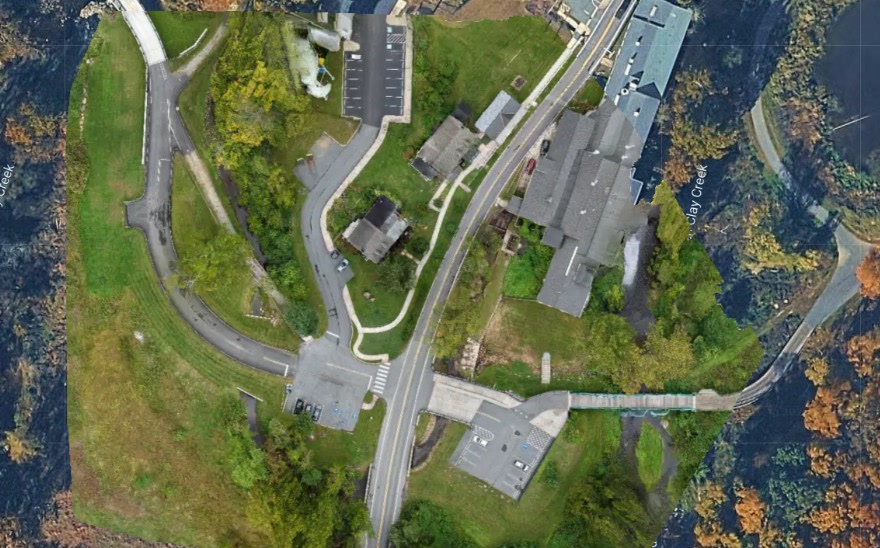
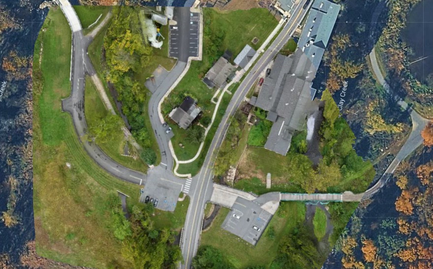
Aerial orthomosaic of a developed site surrounded by woodland Surface model Orthomosaic Basemap © Google
01 / Surface model

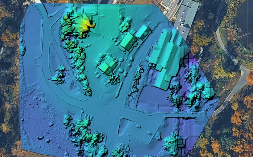
Read the terrain at a glance.

A colorized surface model shows elevation change across the entire site. High points, low spots, and drainage paths stand out in seconds, so teams can plan grading, cut/fill, and drainage before equipment moves.

  • Grade and drainage review
  • Cut and fill planning
  • Ready for CAD and GIS
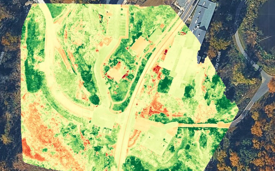
Aerial orthomosaic of a developed site and surrounding vegetation Plant health Orthomosaic Basemap © Google
02 / Plant health

Spot vegetation stress early.

Plant health maps turn ordinary imagery into a clear read on vegetation vigor. Healthy growth, stressed areas, and bare ground separate instantly, helping land managers and environmental teams focus field visits where they matter most.

  • Vegetation vigor mapping
  • Wetland and buffer review
  • Change tracking between flights
3D model
03 / 3D model

Walk the site from any angle.

Photogrammetry turns a single flight into a measurable 3D record of your site. Measure stockpiles, check progress, and review existing conditions from your desk instead of the field.

  • Measurable point cloud and mesh
  • Existing conditions review
  • Progress and volume review
Technology and workflow

Smarter Processing. Faster Turnaround. Same Rigor.

Capturing aerial data is only half the job. Our AI-assisted workflow shortens turnaround times and improves consistency without cutting corners on accuracy.

See How We Process Data
PPK-refined positioning
Accelerated point cloud processing
Automated quality control
Change detection between flights
Technology supports judgment

Every AI-assisted output is reviewed by our team before it reaches you.

Why Owls Nest Studio

Built around the standards your team already works to.

Our work is designed to become a dependable part of your process, not another disconnected source of project information.

Mapping-Grade Deliverables

Orthos, DSM/DTM, contours, point clouds, and volume reports, ready for CAD and GIS.

Certified and Insured Operations

FAA Part 107 pilots, comprehensive liability coverage, and active-site safety protocols.

Fast, AI-Accelerated Turnaround

Technology-driven processing gets accurate deliverables into your hands faster.

Ground Control + PPK Accuracy

Operators set and check every GNSS-measured control point, then PPK refines the data, down to sub-centimeter.

Responsive Local Team

Based in Delaware, with recurring monitoring and rush capture in 24–72 hrs.

Secure Data Handling

Client data is stored and transmitted securely, with clear data-ownership terms.

How we work

From site assessment to integrated deliverables.

View Full Process
STEP 01

Scope and Site Assessment

We review project requirements, airspace considerations, and site access before scheduling.

STEP 02

Flight Planning

Custom plans are built around accuracy, deliverable format, and site conditions.

STEP 03

Control and Capture

We set and measure ground control with our GNSS receiver, then fly to spec.

STEP 04

Processing and QA

PPK processing ties every image to precise positions, with AI-assisted checks and hands-on review.

STEP 05

Delivery and Integration

Final deliverables arrive in your required formats with integration support.

STEP 06

Recurring Monitoring

Optional scheduled flights track progress and volumes over time.

Start a project

Let's Talk About Your Next Project

Whether you need a one-time site map, a volume report, or ongoing construction monitoring, our team is ready to scope your project and provide a clear, detailed proposal.

  • Response within 1 business day
  • Delaware and tri-state region
  • Rapid response available